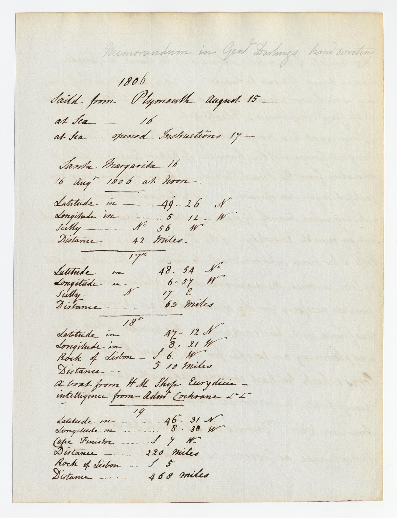
Memorandum in Genl
Darlings hand writing
1806
Saild from Plymouth August 15
at Sea — 16
at Sea opened instructions 17
Santa Margarita 16
16 Augt 1806 at noon
| Latitude in ----- | 49°..26 N |
| Longitude in----- | 5.12.. W |
| [Tu]lly---- | No 56 W |
| Distance---- | 42 miles |
17th
| Latitude in----- | 48° . 54 No |
| Longitude---- | 6..57 W |
| [Tu]lly--- | N 17 E |
| Distance---- | 63 miles |
18th
| Latitude in---- | 47°..12 N |
| Longitude in--- | 8. 21 W |
| Rock of Lisbon — | [illegible] 6. W |
| Distance--- | 5 10 miles |
A boat from H M Ship Eurydicia
intelligence from Adml Cochrane [&c &c]
19
| Latitude in---- | 46°. 31 N |
| Longitude---- | 8. 38 W |
| Cape [Finestre] | [illegible] 7 W |
| Distance---- | 220 miles |
| Rock of Lisbon---- | [illegible] 5 |
| Distance----- | 468 miles |
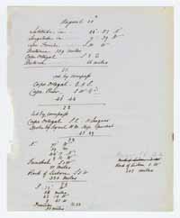
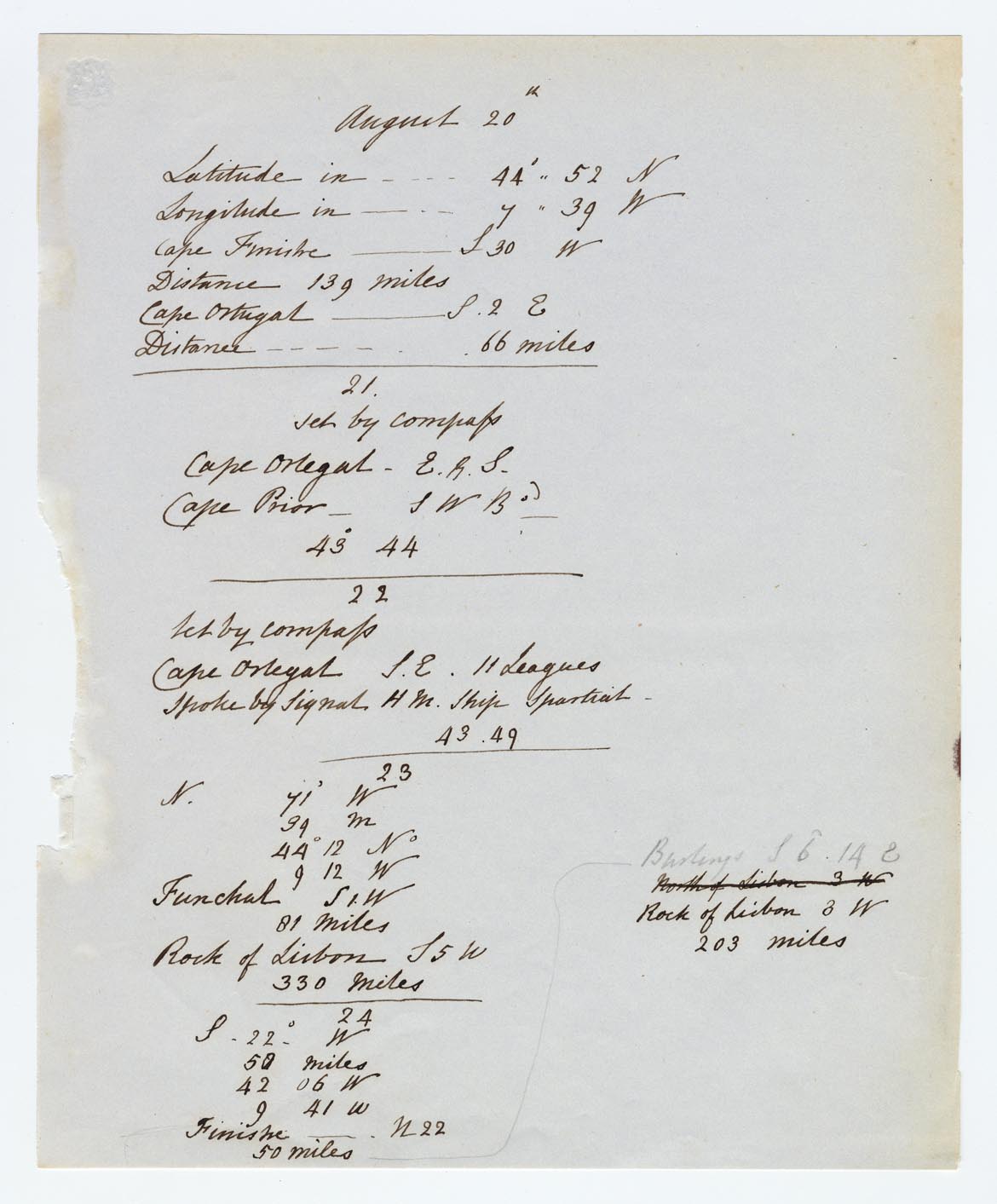
August 20th
| Latitude in---- | 44°.. 52 N |
| Longitude in---- | 7.. 39 W |
| Cape Finestre … | [illegible] 30 W |
| Distance 139 miles | |
| Cape Ortugal --- | [illegible] 2 E |
| Distance---- | 66 miles |
21
Set by compass
| Cape Ortugal ---- | E [illegible] S |
| Cape Prior — | S W B[illegible] |
| 43° 44 |
22
Set by compass
| Cape Ortugal | [S] E 11 Leagues |
| Spoke by Signal H M Ship [Spartial] | 43.49 |
23
| N | 71° W |
| 39 M |
| 44° 12 No |
| | 9 12 W |
| Funchal | S [illegible] W |
| Rock of Lisbon | S 5 W |
| 330 miles |
24
| N. | 22° W |
| 50 miles |
| 42 06 W |
| 9 41 W |
| Finestre---- | N 22 |
| 50 miles |
[arrow leading to right hand side of page and up]
| B[illegible]ings | S 6° 14 |
North of Lisbon | 3 W |
| Rock of Lisbon | 3 W |
| 203 Miles |