Block 10 Area G Archaeological Report
Block 10, Area G Archaeological Report, Block 10Originally entitled: "Archaeological Report
Block 10, Area G (Foundations East of Shewmake House)"
Colonial Williamsburg Foundation Library Research Report
Series - 1233
Colonial Williamsburg Foundation Library
Williamsburg, Virginia
1990
ARCHAEOLOGICAL REPORT
BLOCK 10, AREA G
(Foundations east of Shewmake House)
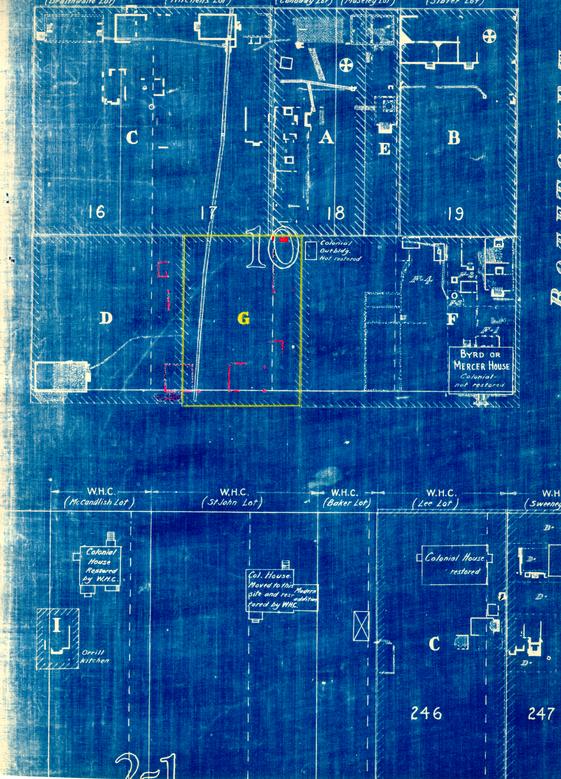
This area is composed of the southern half of Colonial Lot No. 17 and a 20' x 105' strip in the southeast corner of Colonial Lot No. 18.
The foundations just west of the Shewmake-Ryland property line were uncovered in 1935 and investigated again in 1941 at the same time the remainder of the foundations to the east were uncovered. Fragmentary remains of foundations of all buildings shown on the Frenchman's Map, in this area, were found.
A - 20' x 20' Building
Only part of the south and west wall of this foundation, including the southwest corner, could be found, although by tracing the fill, indications of the original wall location could be clearly defined. This proved to be a 20'0" x 20'0" building of eighteenth-century construction, which is shown on the Frenchman's Map. No chimney foundation was found nor indications of one having existed. The original use of the building, which was on this site, could not be determined as only a few pieces of broken eighteenth century china were found. According to the size and location of the foundation, this may be the remains of an early shop. It did not have a basement.
| Brick size - | 8 ½ x 4 x 2 ½ |
| Color - | Red |
| Bond - | English |
| Mortar - | Shell |
| Condition - | Bad |
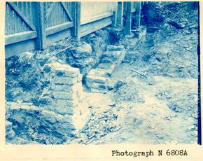
Adjoining the southeast corner of this foundation are the remains of what appears to have been a bulkhead wall (a-1) built at the south end of 2 a nineteenth-century brick drain before it was extended into Francis Street.
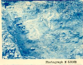
See Photographs N6808A and N6808B.
B and C Foundations
These two foundations were uncovered in 1935 and again in 1941. Foundation B is the remains of a 13" wall, 15 feet in length, which appears to be the west wall of an outbuilding that was originally on this site. Foundation C appears to have been a small outbuilding that was probably a privy. Both of these foundations appear to be the remains of buildings shown on the Frenchman's Map. Neither of the original buildings on this site had basements.
See archaeological drawing Block 10, Area D.
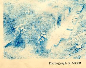
D - Foundation
This appears to have been a 17'0" x 1810" building with a fireplace (d-1) on the north end. No evidence was discovered that could determine its original use although it may have been a kitchen or small dwelling used in connection with other nearby buildings.
| Brick size - | 9" x 4¼" x 2-3/8" |
| Color - | Buff |
| Bond - | English |
| Mortar - | Shell |
| Condition - | Poor |
See Photograph N6808C.
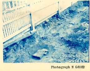
E - Foundation
Fragmentary remains of the southwest and southeast corners (e-1) (e-2) of a building without a basement were found in this area. Also uncovered were several bricks which appear to be part of the west wall (e-3) of the same foundation. The Frenchman's Map does not show a building on this site; therefore it appears that this building possibly existed prior to 3 or after the map was made in 1782-86.
| Brick size - | 8 ½ x 4-1/8 x 2 ½ to 2-¾ |
| Color - | Light red |
| Bond - | English |
| Mortar - | Shell |
| Condition - | Bad |
See Photograph N6808D.
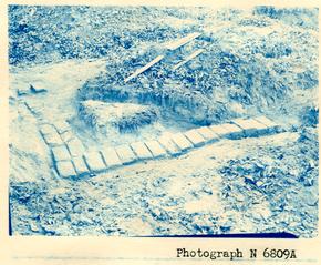
F - Foundation
Only a portion of the north and east wall, including the northeast corner, of this foundation was found. The remainder of the brickwork had been previously destroyed, making it impossible to determine its original dimensions. Evidently a building existed on this site in 1782 since the Frenchman's Map shows one approximately in this location.
| Brick size - | 8-¾" x 4-¾" x 3" |
| Color - | Buff with glazed headers |
| Bond - | English |
| Mortar - | Shell |
| Condition - | Bad |
See Photograph N6809A.
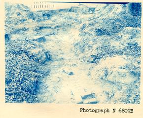
G - Foundation
The southwest corner and a small portion of the east wall was all that could be found in this area. The Frenchman's Map shows a building approximately on this site which coincides closely with the fragmentary evidence which was uncovered.
| Brick size - | 8 ½" x 4" x 2 ½" |
| Color - | Red and buff |
| Bond - | English |
| Mortar - | Shell |
| Condition - | Bad |
See Photograph N6809B.
H - Chimney
This chimney is on the south end of a foundation which was partly 4 uncovered in 1932. It is located in the rear of what was then known as the Canaday lot. It appears to be the southern part of the two long buildings which are shown on the Frenchman's Map and located in rear of what is now known as the Nancy Camp House.
See archaeological drawing Block 10, Area A.
| Brick sizes - | 8½" x 4" x 2½" |
| Color - | Red and buff |
| Bond - | English |
| Mortar - | Shell |
| Condition - | Fair |
See Photograph N6809B.
Colonial Williamsburg
Architectural Department
 Photograph
N 6808A
Photograph
N 6808A
 Photograph
N 6808B
Photograph
N 6808B
 Photograph
N 6808C
Photograph
N 6808C
 Photograph
N 6808D
Photograph
N 6808D
 Photograph
N 6809A
Photograph
N 6809A
 Photograph
N 6809B
Photograph
N 6809B
Over-sized image. Digital version unavailable.